Land use planning is a critical component of the planning process for local government areas (LGAs), as it helps to ensure that land is used and developed in a way that supports the needs and priorities of the community.
Whether an LGA is located in a metropolitan or regional area, effective land use planning is essential for managing growth, protecting the environment, and promoting sustainable development.
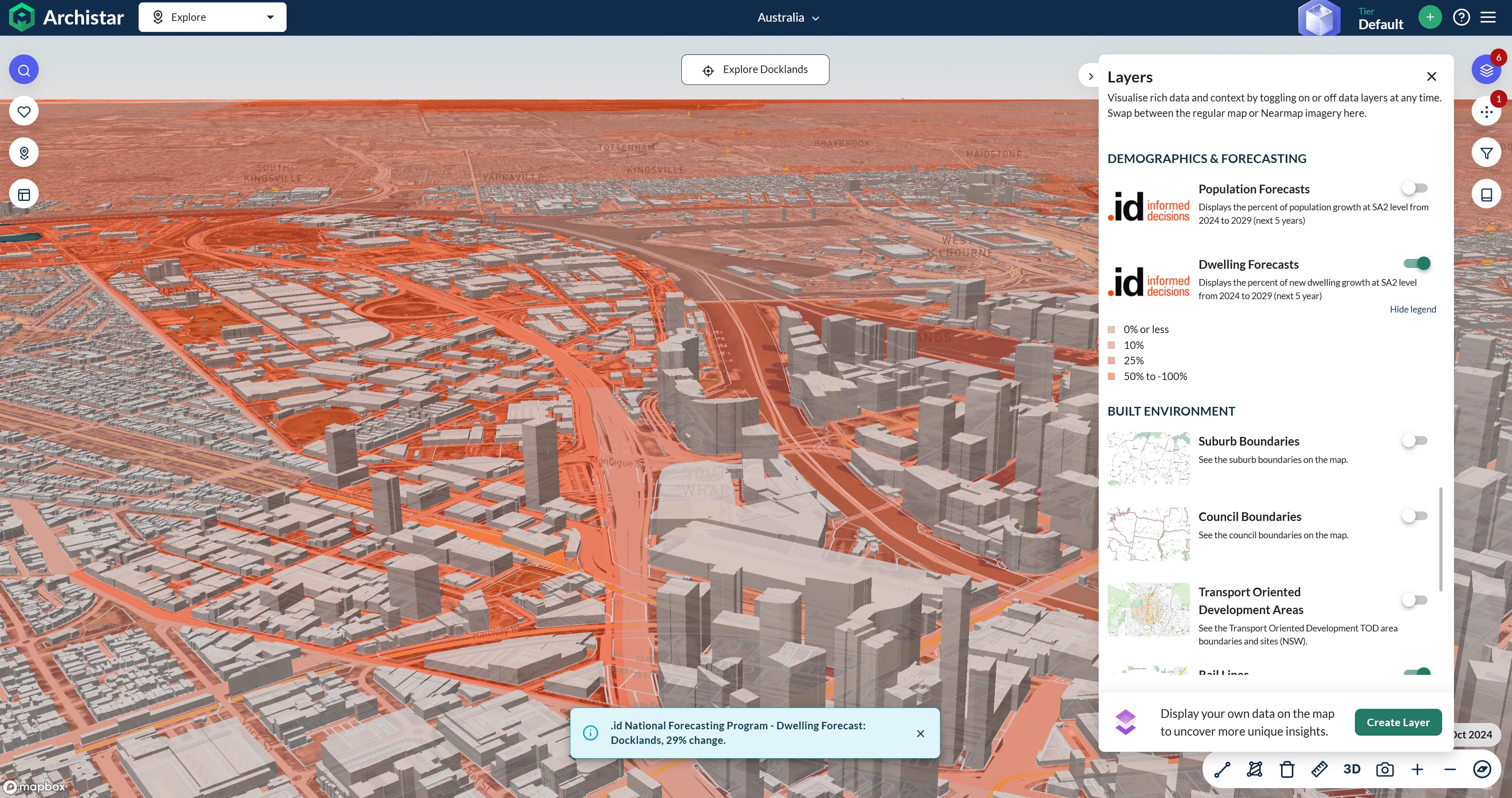
Accounting for Dwelling Forecasts and Residential Development
One of the key aspects of land use planning in LGAs is the consideration of dwelling forecasts and residential development data. By analysing these factors, planners can better understand the current and future housing needs of the community and develop strategies to accommodate growth in a way that aligns with the LGA's overall vision and priorities.
In metropolitan LGAs, where population growth and housing demand are often more pronounced, land use planning plays a crucial role in managing the competing demands for residential, commercial, and industrial land. Planners must carefully balance the need for new housing with the preservation of green spaces, the protection of valuable agricultural land, and the mitigation of potential conflicts between different land uses.
In regional LGAs, land use planning is equally important, but the challenges and priorities may differ. While population growth may be slower, regional LGAs often face unique challenges related to the preservation of natural resources, the support of local industries (such as agriculture. mining and tourism), and the provision of essential infrastructure and services to dispersed communities.
The Importance of Land Use Planning
Regardless of an LGA's location, effective land use planning is essential for promoting sustainable development, protecting the environment, and ensuring the long-term well-being of the community. By carefully considering factors such as dwelling forecasts, residential development, and the unique characteristics of the local area, planners can develop strategies that:
- Accommodate population growth and housing needs in a way that minimizes the impact on the environment and preserves the character of the community.
- Protect valuable natural resources, such as agricultural land, forests, and waterways, from inappropriate development.
- Promote the efficient use of infrastructure and services, reducing the costs and environmental impacts associated with sprawling development.
- Foster the development of vibrant, liveable communities that offer a high quality of life for residents.
How Councils Can Improve Land Use Planning
Some councils have adopted a proactive and flexible approach to land use planning. When faced with rapid population growth, they have implemented planning schemes that allow for greater housing diversity and density in key activity centres. This enables more efficient use of land and infrastructure and provides a range of housing options to meet a community's needs. Flexible zoning allows an LGA to adapt to changing market demands and demographic shifts.
Additionally, by rezoning underutilized industrial areas for mixed-use development, LGAs can help facilitate the transformation of former industrial precincts into vibrant, high-density neighbourhoods. This allows an LGA accommodate population growth within its existing footprint, reducing sprawl and making efficient use of infrastructure. Careful planning and community engagement helps ensure such developments integrate well with surrounding areas.
Sometimes though an LGA’s planning scheme has the effect of severely limiting opportunities for medium-density housing - forcing new developments into greenfield areas on urban fringes. This can result in car-dependent, low-density sprawl that is costly to service with infrastructure and public transport. Better population forecasting and a more flexible, transit-oriented approach to planning would enable a more efficient use of land and infrastructure within an LGA.
There are also challenges in managing competing demands for land use. Sometimes an LGA’s planning scheme can struggle to balance the needs of residential, agricultural, and industrial development. This typically leads to land use conflicts, with some agricultural areas being encroached upon by urban expansion. More robust population and dwelling projections, combined with a clearer strategic vision for a city's future growth, would help councils make more informed and proactive decisions about land use.
Planning for Success
Councils that take a flexible, evidence-based, and community-focused approach to land use planning have generally been more successful in accommodating growth and change. Conversely, councils that have relied on overly restrictive or ad-hoc planning have often faced issues with inefficient land use, infrastructure challenges, and land use conflicts. Improved population and dwelling forecasting can help councils make more informed decisions about the appropriate use of land within their boundaries.
Land use planning is a critical component of the planning process for LGAs - regardless of their location. By carefully considering factors such as dwelling forecasts and residential development and tailoring strategies to the unique needs and priorities of the local community, planners can help to ensure that land is used and developed in a way that supports the long-term sustainability and well-being of the LGA.
Summary
Land use planning in LGAs requires an in depth understanding residential development data, dwelling forecast & population forecast data over extended time horizons - not just the next 5 years.
Our National Forecasting Program provides a single, standardised source of population data. It allows you to drill down from a national to a local level, knowing the assumptions and methodology applied to forecast the future of any place is consistent and comparable.
The information from .id’s National Forecasting Program can be accessed via a several services from .id (informed decisions), ranging from published forecast data and analysis for regions, to one-off reports, data partnerships, tailored forecasting services and specialised consulting.