What and where is the centre of population?
A client contacted us recently to request a calculation of the centre of population for their local area. Steve quickly responded to this request, and some discussion and speculation within the team followed on where Melbourne’s population centre is.
So – what is the centre of population and why does it matter? …
.jpg)
What is the centre of population?
The centre of population is one way to describe the geographic distribution of a population. This point marks the average latitude and longitude around which the population is distributed. The centre of population is sometimes described as the ‘centre of gravity of a population’ as it is determined by a combination of the density and geographic distribution of the population.
Why might you be interested in where the centre of population is?
Knowing where the centre of population is can assist with planning services which are, theoretically, equally accessible to all. The location of the centre of population may not be as easily accessed to all due to differences in transport options.
The centre of population can be calculated for any population of interest, the examples below are for the total population but it would be just as straight-forward to calculate a centre of population based on young children or the older population, in order to conveniently locate targeted services.
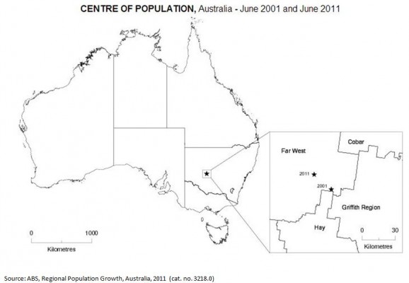
Where is Australia’s centre of population?
The Australian Bureau of Statistics (ABS) publish the centre of population figure for Australia, the states and territories, and the greater capital cities in the annual publication Regional Population Growth (cat. no. 3218.0). According to the ABS, Australia’s centre of population at June 2011 was 39 kilometres east of the small service town of Ivanhoe, in western New South Wales. This reflects the concentration of population in south-east Australia. The centre of population moved 21 kilometres north-west in the ten years from 2001 to 2011. This shift reflects strong population growth in Queensland and Western Australia over this period.
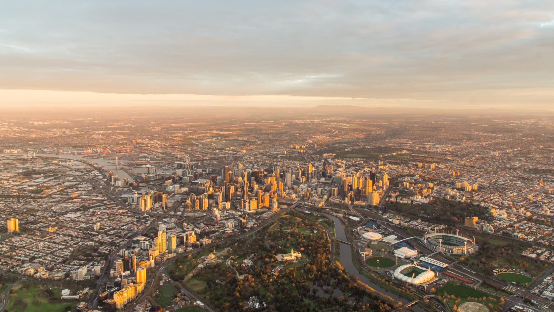
Where is Melbourne’s centre of population?
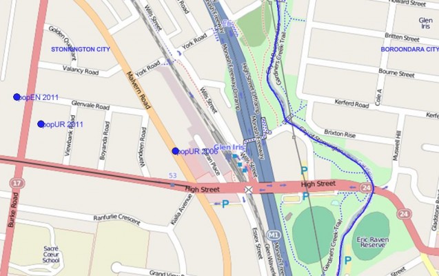
According to the ABS, Greater Melbourne’s centre of population at June 2011 was near the Monash Freeway, in the suburb of Glen Iris. We decided to look at how the location of the centre of population varied depending on the census variable, enumerated versus the usually resident population. We were surprised to see how similar these were.
For the state of Victoria, the centre of population was in the suburb of Coburg North. In the ten years to 2011, the centre moved 2.0 kilometres south, towards Melbourne’s central business district. The change in the location of the centre of population over time reflects the population growth in the inner city.
How did Steve calculate the demographic centre of population?
Steve used census data from 2006 and 2011 , multiplied the enumerated and usual residence population of the meshblock with the latitude and longtitude coordinates (independently). He then divided the sum of the x- and y-coordinates by the sum of each population to arrive at the exact location of the centre of population. Piece of cake!
Access the Australian Community Profile now! You will find Census results for each Capital City, State, Southeast Queensland and Australia on topics including population, age, country of birth, languages spoken, occupations, industries, employment, disability, income, qualifications, transport and much more…
Access the new profile.id sites and other population statistics for Local Government Areas and suburbs at .id’s demographic resource centre.
![]()
Esther - Team Forecast
Esther joined .id after working in the demography teams at both Statistics New Zealand and the Australian Bureau of Statistics producing national and regional statistics. Esther produces the top-down model for .id’s SAFi (Small Area Forecast information). This involves synthesising overseas, interstate and regional migration patterns to quantify regional change. Esther loves the way statistics assist in understanding our communities and can dispell urban myths or stereotypes.