Who pays for our tools?
If you’ve accessed one of our ‘free’ online tools, you may be wondering ‘Who pays for all this?”
The short answer: your local council (probably).
Jump ahead:
- I can’t find a profile for my area
- I can’t see a particular dataset in my area
- Why can’t I see the same level of detail in my area?
- How can I access this information for my area?
The longer answer
For 20 years, we’ve been building resources that are made freely available online to help people everywhere make informed decisions.
The reason they’re made freely available to the public is the sites are paid for by subscribing authorities – mostly local councils, however other regional organisations such as Primary Health Networks and Regional Development Australia who also subscribe to our tools.
Our ‘Resources’
When we refer to our Resources, we’re talking about a range of demographic, economic and forecasting tools we build for our subscribers.
The most popular ones are our community profiles, economic profiles, population forecasts and our social atlas tool. People usually discover these tools when they ask Google a specific question about a place in Australia or New Zealand.
You can see a full list of publicly-available tools and other free resources in our demographic resource centre.
Why can’t I find a profile for my area?
The .id tools that are publicly-available vary from place to place, so you may find one or more of our tools aren’t available in your area.
While hundreds of councils across Australia and New Zealand subscribe to our resources, some only subscribe to tools that are relevant to their internal decision making, and others don’t subscribe at all. As a result, you may not be able to find a profile for your community.
Again, check out our demographic resource centre for a full list of free resources, including national profiles and demographic and economic indicator pages.
Or, register your interest in getting a profile for your area here.
Why can’t I see a particular dataset for my area?
profile.id and economy.id, are heavily customised to suit the local area. As a result, the menu items and the data in the tools vary significantly from place to place.
The benefits of tailoring content to each area;
- We make sure the data are locally relevant
Some datasets, such as Gross Regional Product from Agricultural activities, aren’t particularly relevant for some places (CBDs, for example), so aren’t always included.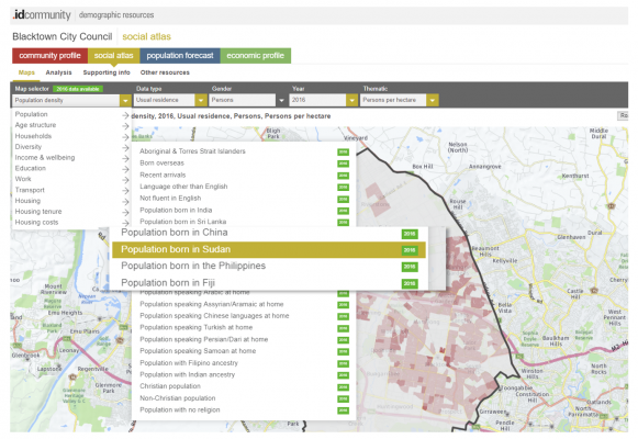
Another example is the choice of Diversity maps used in the social atlas for an area. We work with the subscribing council to select cultural and ethnic groups that are prominent in the community, or of interest to their community services teams.
- Different subscription options
Have you noticed that the content of some of our sites is different from place to place?
We build each tool from standard and optional modules (items on the side menu).
Optional modules give more detailed insights into particular groups (such as the Communities of interest module in profile.id) or special tools (such as the location quotient analysis tool in economy.id).
Councils pay a higher subscription to have these modules included. This is great if you’re in that area, but it can be difficult if you’re trying to compare two neighbouring areas with different subscription options (if you are, you might be interested in our Placemaker Census Explorer tool – you pay a subscription to access it, but it offers national coverage).
- The level of detail (statistical geography) is different, depending on the subscriber
When a regional organisation subscribes, they typically want to view data for a collection of Local Government Areas (LGAs) in their region, whereas when a local council subscribes, they want to see data at a sub-LGA level (often suburbs or districts, or what we typically call small areas).
When a council first subscribes to a community profile, we sit down with them to figure out local borders that make sense to them (the way Census data is coded to places often doesn’t align neatly to the meaningful local boundaries). The result: data is presented in a way it makes sense to the subscriber, but it means you may get a different level of detail, depending which tool or place you’re looking at.
How can I get this information for my area?
If you can’t find the data you need for your area, you can register your interest in accessing it here.
We compile and present these expressions of interest to local councils, to demonstrate community demand for accessible, easy-to-use data that helps people make informed decisions in both your local council and community.
How we develop these tools
Our team has a unique blend of skills: our software developers and consultants work alongside demographers, forecasters, urban economists, housing analysts and experts in GIS and mapping technologies to build these tools, share our expertise and help people interpret and use the results.
If you have feedback on any of our resources, we’d love to hear from you.
.id is a team of population experts, who use a unique combination of online tools and consulting to help organisations decide where and when to locate their facilities and services, to meet the needs of changing populations. We provide free resources to help you make the most of demographic data. Access .id’s demographic resources here.
.jpg)