Forty councils and regions across Australia have now signed on to economy.id, the online economic and workforce profile. economy.id helps councils to describe, explore and promote their economy. You can see the full list on our website. economy.id is a fantastic resource for understanding the size of your local economy, how it is changing, the breakdown of key industries and characteristics of the workers in each industry. There is also a section called “Infrastructure” which can be used as a promotional tool. Read on to see how.

The infrastructure page is accessed under the “Highlights and Introduction” menu item at the top of the menu. It provides a way of presenting key facts about your area that may be of interest to a potential business looking to locate there. These include:
- Location
- Transportation networks
- Distances to key ports and cities
- Major industrial precincts
- Major assets in the area
When we prepare the economic profile for a Local Government Area we put together a list of these facts and facilities, to go online. However the lists can be amended based on information provided by our clients. If you are an economy.id subscriber, please feel free to send us a list of facilities which you’d like included in here.
Major assets are shown in the following categories:
- Attractions and landmarks
- Education facilities
- Health Care facilities
- Lifestyle assets
- Natural assets
- Retail and Shopping
The other main feature of the infrastructure page is an interactive map. Initially this is a blank map with a boundary, which allows users to simply explore the area using Bing maps (road or satellite views). But we offer the option for all our clients to send us GIS layers (up to 15 layers in Mapinfo or ESRI compatible formats) to enhance the users’ experience, and provide information about additional council facilities.
Many councils are looking to develop websites allowing residents and business users to explore the location of council facilities. Economy.id has this built in – just send us the GIS layers and it’s all there online.
So far, a few councils have taken us up on this offer.
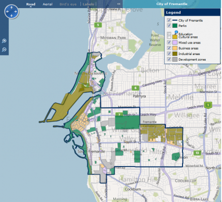
The City of Fremantle uses the infrastructure page to display detailed zoning maps for the LGA.

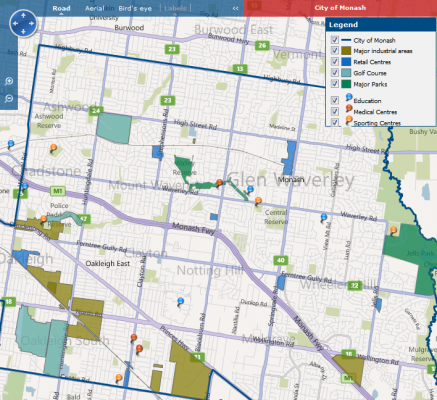
The City of Monash uses the infrastructure page to display the location of useful facilities for businesses, such as Shopping Centres, Medical Centres and even Golf Courses!

The Northern Sydney Regional Organisation of Councils uses the infrastructure page to show the locations of all their industrial areas, sporting centres and education facilities.
Once loaded on the site, the layers are interactive, meaning that users can zoom in and see the boundary or location in more details, and hover their mouse over the facility to get a pop-up with details of that place.
A business looking to establish in the area can explore places which might be close to a shopping centre, medical or sporting facility for their employees, then go to the “Employment Locations” page to see how many people currently work in that local area and which industries they work in. They can also use the labour force section to see what qualifications residents and commuters have, and what labour pool they could reasonably access from that location.
So if you are already an economy.id client, feel free to send us some mapping layers – we’ll put them online and your users can start exploring your area in more detail. There is no extra charge for this service, which is included as a standard feature of .id’s local economic profiles.
.id is a team of demographers, population forecasters, spatial planners, urban economists, and data experts who use a unique combination of online tools and consulting to help governments and organisations understand their local areas. Access our free demographic resources here


