The 50 largest cities and towns in Australia, by population | 2018 update
This is the annual update to Glenn’s incredibly popular Top 50 cities in Australia blog. Updated population data is released every year by the ABS. Of course, everyone loves a ranking, and here you can see the main urban areas in Australia, which remains one of the most urbanised nations in the world.
Updated: read the 2020 update to these figures here

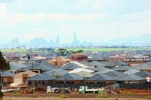
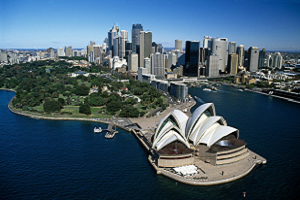
Sydney and Melbourne continue to top the list, a long way ahead of even third place. Our two biggest cities, combined, make about 40% of the nation’s population.
Why are we using ‘2017’ figures?
The Australian Bureau of Statistics’ Regional Population Growth report was released on 24 April 2018. As there is always a delay between collecting, calculating and releasing these figures, the date for the data always appears to be ‘last year’. Rest assured, these are the most up-to-date population data available.
Deciding where a place starts and finishes
Note that these figures are based on the “Significant Urban Area” geography. This is defined by the ABS as an aggregate of areas which roughly contain the continuous urban extent of a city without major gaps. It is different to the figures you might see elsewhere, which are based on “Greater Capital City Statistical Areas” (GCCSAs), and cover a wider labour market region where most people commute into the capitals to work.
For instance, the Sydney and Melbourne GCCSAs have 2017 populations of 5,131,326 and 4,850,740 respectively. You can see the numbers below are a bit less than that, particularly for Sydney. That’s because non-contiguous urban areas are separated out in the Significant Urban Area classification.
Sydney’s GCCSA population includes the Central Coast while the Significant Urban Area excludes it as it’s non-contiguous. The same goes for the centre of Melton on the outskirts of Melbourne. These are separate centres in this view of the world. This provides a better measure of true bounded urban areas, but neither version is “correct” or better than the other. It also enables capital city populations to be compared to regional centres in the list below, which don’t have a wider capital city area defined.
On this measure, Sydney is only marginally larger than Melbourne, and if population growth trends continue, Melbourne (which added 124,000 more people than Sydney in the last 5 years) will once again become Australia’s largest city within 4 years (Melbourne was bigger than Sydney through much of the late 1800s). If Greater Capital City areas are used, it will take a bit longer.
Notable changes
The top 50 cities go down to a population of just under 28,000, with Nelson Bay, NSW, coming in at #50 this time, and replacing Alice Springs, which drops out, leaving only one place in the Northern Territory in the top 50 (Darwin).
The top 5 haven’t changed, and, apart from Sydney and Melbourne possibly swapping places, won’t change for a while. Adelaide is the slowest growing of our capitals, but still has twice the population of the Gold Coast, the largest regional area in the list.
Hobart is booming -the Tasmanian capital, while only the 13th largest city in Australia, had a growth rate equal to Adelaide over 5 years, and significantly higher at 1.1% in the past year.
Perth still grew strongly over 5 years (7.6%), but over the last year growth has fallen to 1.0% – actually lower than Hobart – with the end of the mining boom and significant out-migration interstate.
This version of the classification also has the advantage of combining areas across state borders. So Albury-Wodonga appears as a single place on this list, coming in at number 20, and having a 1.5% growth rate.
Population rivalries
Other than Sydney-Melbourne, there are a few other key rivalries represented in the table.
Ballarat and Bendigo appear right next to each other at 18 and 19 in the table and either side of 100,000 people. Growth rates are very similar, with Bendigo growing slightly more over 5 years, but 1 year growth goes to Ballarat.
Hobart is number 13, while Launceston is number 21 – but Hobart has twice the growth rate.
Wollongong’s growth rate exceeds that of Newcastle, though Newcastle remains much larger.
This method of breaking up the population also has some interesting idiosyncrasies. As mentioned, Central Coast and Melton are considered separate cities to Sydney and Melbourne respectively. Traralgon and Morwell are combined, but Moe, which many would consider part of the same urban area in the Latrobe Valley, is far enough apart to be separate (and outside the top 50).
We get a lot of questions with these blogs!
“Where is <insert place name here>? It’s way bigger than <these> places”.
Chances are if you can’t see your place, it’s considered part of a larger metropolitan area. A good example is Ipswich, Queensland, which is part of the Brisbane urban area.
Estimated Resident Populations are now updated on all profile.id and economy.id sites to 2017, and will continue to be updated annually to the next Census.


Generally speaking, population of societies are increasing rapidly so are the needs. Need of food, shelter and cloth is the top priority of each men out there struggling for their life. Then main thing they wanted is a security assurance for their life that is obvious and they should be provided by that.
Generally speaking, population of societies are increasing rapidly so are the needs. Need of food, shelter and cloth is the top priority of each men out there struggling for their life. Then main thing they wanted is a security assurance for their life that is obvious and they should be provided by that.
Interesting figures, and it’s amazing that Melbourne is both the second largest city in the country (by a small margin) and the also fastest growing city (by a large margin) in both absolute and percentage terms.
That sounds a bit of a spurious measure to use. What is contiguous in this context? How do you measure major gaps by this standard? Is Windsor part of the Sydney urban area? Or if Windsor is then how about Richmond? Both are on the suburban train line but there are a few farms between them and between Rouse Hill too. By the same token if you look at Central Coast it is just a few Km from Palm Beach on Sydney’s Northern Beaches to Ettalong across Broken Bay ie a short ferry ride and also has suburban trains running to Central on regular timetables through the day. When can Melton be considered part of Melbourne – how big is the gap allowed to be and how is that specific number decided? In summary contiguous urban area seems a pretty whimsical way of defining a city’s extent particularly in Australia with its large distances between capital cities and low density urban areas and as the urban fringe shifts and changes. In the end it doesn’t accord with the idea of a city as a collection of people living close enough together to interact daily with each other in economic and social activities rather than as a physical built up area. That’s why the “greater metropolitan area” standard is a more appropriate definition for Australia at least.
Hi Alex – thanks for the comment – some good questions in there! Contiguous urban is a difficult thing to define. The ABS says that “Significant Urban Areas are based on Urban Centres and Localities, but are based on the larger SA2 units” http://www.abs.gov.au/ausstats/abs@.nsf/Lookup/by%20Subject/1270.0.55.004~July%202016~Main%20Features~Significant%20Urban%20Area%20(SUA)~5
The issue of what’s contiguous was considered by Dr G J R Linge in the 1960s, and ever since, urban centres in Australia have been defined by using the “Linge Criteria”. These set out what can be considered contiguous urban development. Mainly based on things like a population density over 200 people per square km, some things about land use etc. They allow for outlying urban centres to be subsumed into larger ones (eg. your Windsor example) if there is a gap of less than 3km in contiguous development. Importantly though this gap has to be by road, so the Palm Beach-Ettalong one certainly doesn’t qualify.
So based on that, in a few years it’s very likely that Melton would become part of Melbourne. Before 2011 Census, Pakenham, on the other side of Melbourne, was a separate urban area, but this was swallowed up by Melbourne based on these criteria.
The use of SA2s to define the Significant Urban Areas slightly extends the UCL definition for the practical reasons that UCLs change too much over time, and are only defined at each Census – so SA2s enable a little more stability, and for other datasets such as the ERP used in this article to be produced on those boundaries.
For capital cities – the larger GCCSA boundaries are more commonly used, but the use of SUAs allows for comparable definitions for all the regional centres as well, so in this way it is very useful for exactly the sort of information that this blog is intending to convey. The main point is that no geographic boundary is a perfect representation of a community and many statements such as “Sydney is bigger than Melbourne” really depend a lot on where you draw that line.
Thanks for the explanation Glenn! I know this blog is about the UCL but it makes reference to GCCSA as well, and I had a question in that regard. I was wondering, if Central Coast is considered as part of Greater Sydney, why is Wollongong not similarly included? From what I can tell its labour market is as connected to Sydney as Central Coast is, and geographically it is closer as well. Do you have any suggestion why there is this seeming incongruity in the ABS definition of GCCSA?
The main rationale seems to be Labour Force – if an area is relatively self-contained and contributes relatively little of its labour to Sydney, it will not be included. Wollongong is more self-contained, while Central Coast has a large share of its labour commuting into Sydney.
Rockhampton Regional Council lost about 37,000 of its local government population when a de-amalgamation occurred in 2014.
I am wondering whether this change which decreased its population from approximately 115,000 also effectively demoted its by 5 places from 18th to 23rd?
No, these areas don’t have anything to do with LGA boundaries – they are defined based on contiguous urban areas. It’s possible that the definition of Rockhampton has changed but it’s unlikely to be by that much. Most likely other areas have just grown by more, pushing it down a few spots.
Brisbane and Gold Coast are now joined and contiguous. They function cooperatively in trade and commerce and are connected by the one suburban rail network That represents a population mass of over 3 million. ABS should really combine the figures.
I find the change in the population calculations for Geelong between this version (260K) and the 2014 version (180K) interesting, especially as the 5 year growth rate is about 30K.
Presumably some areas that weren’t included in the previous calculation are included in this. My guess is that Torquay (and probably Leopold) is now considered as part of the Geelong SUA instead of separate.
Hi Glenn,
Thanks for the thoughtful analysis. Could you link to the ABS dataset you used here? Curious to dig in more — specifically looking to disaggregate each SUA into the areas that comprise it
Thank you for an interesting, clear, and informative article
We go through the population of Albany from the period of 2014-18 and we clearly notice that the population has increased by 200 in the past 5 years. From this, it has been seen that the population each year goes up by 40… http://uspopulation2019.com/population-of-albany-2019.html
Thank you Glenn for a very informative explanation of the importance of statistical geography on the population figures. A great blog.
I remain an ardent fan of the Linge Criteria and UCLs.
I would love to see you explain why Post Codes are good for delivering letters and not for collecting statistics.
My best wishes to the ABS which tells it how it is not how we want it to be.
Hi Glenn Is there a list of postcodes that correlate to these significant urban areas?
Hi John,
Postcodes have no correlation to significant urban areas – they are designed for the delivery of mail, and can cover both urban and rural areas. The ABS may be able to provide a population weighted concordance between postal areas (their approximation of postcodes) to SUAs or other geographies, but there is no one-to-one match-up.
You lot ain’t expert on shit what about the 500 000 that live in logan city in Qld
Hi Jeff, and thanks for your eloquent conversation starter! This is a very common query around the size of urban centres, and more often in Brisbane than any other city. Logan City in 2018 had a population of 326,615 people, not quite 500,000 but it’s certainly heading towards that vicinity in the next 30 years or so, with substantial growth suburbs like Marsden and Yarrabilba. However, Logan City is considered part of Greater Brisbane and so is all part of Brisbane’s 2,326,000 people. Like many suburban areas of capital cities around Australia, it’s subsumed into the larger city’s population. Most of the population is only 20-30km south of Brisbane CBD, and forms a contiguous urban area with this.
I think this question arises most with Brisbane (though the same question could be asked about Melton in Melbourne, the Central Coast in Sydney etc.) because people think of Brisbane as a single LGA, since the 1920s amalgamation created a super-council much larger than any other in Australia – but the urban agglomeration of Brisbane has extended well beyond the LGA boundary now and it’s right to include areas like Logan, Moreton Bay, Redland and Ipswich as part of the metropolitan area. The real question is when Gold Coast will be considered to have joined Brisbane as a single urban area, as it’s rapidly encouraging on the boundary at places like Pimpama.
I hope this clarifies the issue. As with all these things, it really depends where you draw the boundary.
Other cities around the world prefer to use council boundaries such as New York City with 8 million people verses it’s metro population of 20,000,000. Why don’t the other capital cities in Australia just merge councils like Brisbane did and have proper city boundaries like the rest of the world? Using this method, Sydney City should have around 2.5 million people, 4.6 million in its continuous urban area and 5.2 in its metro area.
No, the American idea of saying a ‘city’ is only defined by council boundaries is silly. NYC is a terrible example, as it has adjacent suburbs in New Jersey that it pretends aren’t part of New York. What’s worse is that these these city council population statistics are published as though they mean something, that they are somehow representative of the size of the whole city. Only America does this. Not Canada, not Mexico, not Europe. The US should change on this – not Australia, and not anyone else.
Does anyone see the Central Coast as part of Sydney? Ask any Sydneysider, or any Coastie for that matter. It is separate, and including it in Sydney’s population is disingenuous. If the Central Coast population is removed from Sydney’s, that makes Melbourne the largest city is Australia, and it has been for many years.
Postcodes have no correlation to significant urban areas – they are designed for the delivery of mail, and can cover both urban and rural areas.
how many countries of the world The United Nations, as the most influential international organization, is often regarded as the starting point for accurate counting. All 193 members of the UN are independent countries recognized all over the world.
I was born in 1933 so have seen a lot of changes in our population and city growth.
I was born and bred in Wollongong and seen it grow from a country town to a medium sized city. After WW2 it was probably the fastest growing city in Australia.
I find it difficult now to think of places like Campbelltown and Windsor/Richmond being called as Sydney, and can imagine older people around other Metro areas have the same problem!
Your list is wrong, no Ipswich or Logan cities. Do your research.
Thanks for the comment Paul. Ipswich and Logan are considered part of the Brisbane metropolitan area, along with the City of Brisbane, Moreton Bay and Redland councils. Both LGAs form a contiguous urban area with a large share of workforce working in the City of Brisbane as well. So they will never appear separately on an urban area list. If you break population up by LGA you can see them.